


UDC 911.52(079.3)
https://doi.org/10.26516/2541-9641.2026.1.166
EDN: KTVUDN
The First Geological Field Training of Students from Peking University in the Baikal Area: Cenozoic Rifting in a Long-Evolved Lithosphere
S.V. Rasskazov1,2, S.N. Kovalenko1, S.V. Snopkov1,3, Во Zhang4, Jinxian Yао4, Ming Tang4
1Irkutsk State University, Irkutsk, Russia
2Institute of the Earth's Crust SB RAS, Irkutsk, Russia
3Irkutsk National Research Technical University, Irkutsk, Russia
4Peking University, Beijing, People's Republic of China
Abstract. This article briefly describes the content of the first field educational geological training of students from Peking University that took place from August 31 to September 7, 2025 in the Tunka Valley and on the northwestern coast of Lake Baikal, where the lithosphere generated during the entire time span of the Earth's evolution, from the Hadean to the Holocene. The objects of observation were Precambrian, Lower Paleozoic, and Mesozoic sedimentary, igneous, and metamorphic rocks of the Siberian paleocontinent and the accreted Hamar-Daban terrane. During the field excursion, the students observed the consequences of Cenozoic rifting that developed in the interaction zone of these tectonic units (along the suture of the Main Sayan Fault) and adjacent areas.
Keywords: Lake Baikal, Tunka Valley, Rocks, Precambrian, Lower Paleozoic, Mesozoic, Siberian paleocontinent, Hamar-Daban terrane, Main Sayan Fault, Cenozoic rifting
Introduction
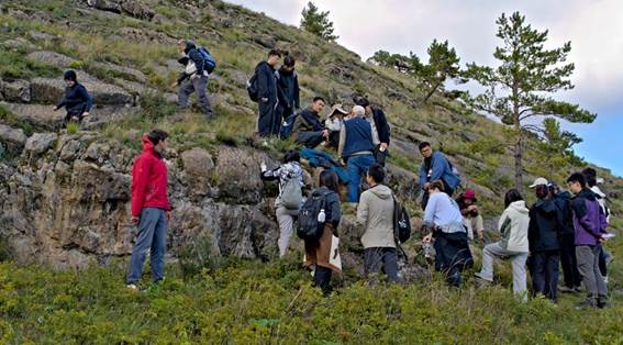
The Baikal region – a representative territory for demonstrating rocks and geological processes covering much of the Earth’s evolution – serves for educational geological trainings of students from the Geological Faculty of Irkutsk State University (ISU) that have been held since the 1950s every year for 1.5 months. From the existing experience, the first geological training of Peking University students on the most indicative geological objects of the territory was arranged in 2025, from August 31 to September 7. For this internship, special review articles were published (Rasskazov et al., 2025; Kovalenko, 2025). The following is a chronology of the internship events with brief geological comments.
August 31. The beginning
Chinese teachers and students, arrived in Irkutsk, were accommodated in the Akademicheskaya Hotel.
September 1. Introduction to the excursion objects, geological observations on the southwestern shore of Lake Baikal – marbles of the Slyudyanka metamorphic complex
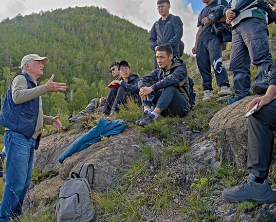
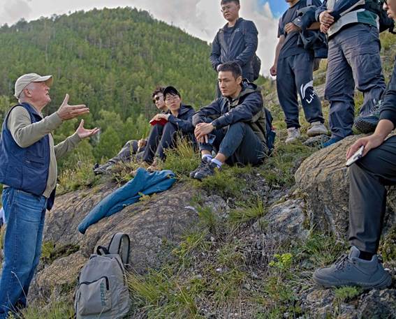
In the morning, Chinese teachers and students visited the Institute of the Earth's Crust of the Siberian Branch of the Russian Academy of Sciences and listened to a lecture on geology and stratigraphy of the Late Precambrian in the south of the Siberian paleocontinent delivered by the Institute researcher T.V. Donskaya and an introductory review of the excursion objects presented by S.V. Rasskazov (Fig. 1).
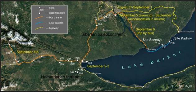
Fig. 1. Distribution of objects for the Field Geological Excursion of teachers and students from Peking University in 2025.
Рис. 1. Распределение объектов полевой геологической экскурсии преподавателей и студентов Пекинского Университета в 2025 г.
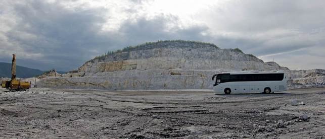
Fig. 2. Upper level of the Pereval quarry for the extraction of low-magnesia marbles for cement production, photo 0732-33.
Рис. 2. Верхний уровень карьера Перевал по добыче низкомагнезиальных мраморов для производства цемента, фото 0732-33.
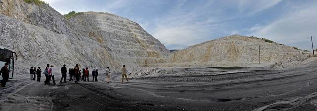
Fig. 3. Lower level of the Pereval quarry for the extraction of low-magnesia marbles for cement production, photo 0737-40.
Рис. 3. Нижний уровень карьера Перевал по добыче низкомагнезиальных мраморов для производства цемента, фото 0737-40.
After lunch, the participants traveled by bus from Irkutsk to the Pereval marble quarry, located on the shore of Lake Baikal, to observe marbles of the Slyudyanka metamorphic complex of the Khamar-Daban terrane (Figs. 2, 3). The latter was accreted to the south of the Siberian paleocontinent in the Early Paleozoic. The accretion time was constrained by the age of granulite facies metamorphism, accompanied by the intrusion of syncollisional granites about 488 Myr ago.
By the end of the day, the participants were accommodated in the guest house Baikal Paradise of the Kultuk village.
September 2–3. Structural suture of the Main Sayan fault between the Siberian paleocontinent and the Khamar-Daban terrane, Cenozoic structures developed along this suture, Cenozoic volcanism
In order to observe the basement rocks of the Siberian paleocontinent, affected by metamorphism of granulite facies, the participants went on a walking route from the guest house along the Circum-Baikal Railway, laid on the northwestern coast of Lake Baikal (Fig. 4).
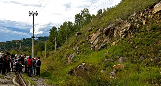
Fig. 4. Outcrop of gneisses of the Sharyzhalgai complex of the Lower Archean in the basement of the Siberian paleocontinent, Circum-Baikal Railway, photo 0838.
Рис. 4. Обнажение гнейсов шарыжалгайского комплекса нижнего архея в фундаменте Сибирского палеоконтинента, Кругобайкальская железная дорога, фото 0838.
The participants observed rocks of dynamometamorphism (mylonites, pseudotachylites) in the Main Sayan Fault – the suture between the Khamar-Daban terrane and the Siberian paleocontinent (Fig. 5). This suture separates the tectonic units of the early Earth with protoliths about 3.82 Gyr old (model age of the common Pb protolith of the basement in the south of the Siberian paleocontinent) and about 4.31 Gyr (model age of the common Pb protolith of the Gargan block) (Rasskazov et al., 2025).
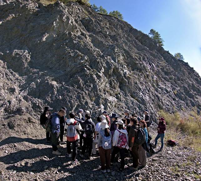
Fig. 5. Outcrop of mylonites and pseudotachylites of the Main Sayan fault on the 2nd km of the Kultuk-Arshan tract, photo 0787-88.
Рис. 5. Обнажение милонитов и псевдотахилитов Главного Саянского разлома на 2-м км тракта Култук–Аршан, фото 0787-88.
At the junction area between the Tunka Valley and the South Baikal Depression of the Baikal Rift System (BRS), the participants sampled rocks of the Kultuk volcano that erupted in the Main Sayan Fault 18–12 Myr ago (Fig. 6). Massive dolerites of subvolcanic bodies, lava flows of porous lavas of subaerial eruptions, as well as pillow lavas and hyaloclastites of underwater volcanic eruptions were observed in outcrops (Fig. 7).
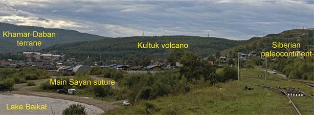
Fig. 6. Edifice of the Kultuk volcano erupted in the Early-Middle Miocene in the reactivated suture zone of the Main Sayan Fault, photo 0842-44.
Рис. 6. Постройка Култукского вулкана, извергавшегося в раннем-среднем миоцене в активизированной шовной зоне Главного Саянского разлома, фото 0842-44.
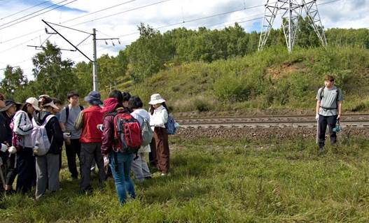
Fig. 7. Outcrop of Lower Miocene pillow lavas and hyaloclastites of the Kultuk volcano, photo 0819a.
Рис. 7. Обнажение нижнемиоценовых подушечных лав и гиалокластитов Култукского вулкана, фото 0819a.
To assess the seismogenic state of the earth's crust in the Baikal Rift System, hydrogeochemical monitoring of groundwater was arranged in the Kultuk Village with sampling of wells and springs every 2 weeks, as well as real-time measurements of the oxidation-reduction potential, pH, and temperature in groundwater wells (every 2 minutes).
September 3. Cenozoic volcanic and sedimentary rocks of the eastern part of the Tunka Rift Valley
The Kultuk–Arshan bus transfer was accompanied with stops for geological observations of outcrops along a highway in the eastern part of the Tunka Valley: 1) 5 km stop, a roadside exposure of overthrusting basement rocks on the Pleistocene-Holocene sediments (Fig. 8);
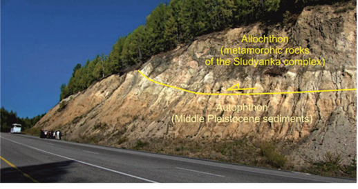
Fig. 8. Overthrusting of metamorphic basement rocks on Middle Pleistocene sediments, photo 0853.
Рис. 8. Надвиг метаморфических пород фундамента на среднеплейстоценовые отложения, фото 0853.
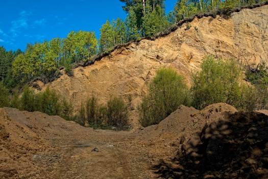
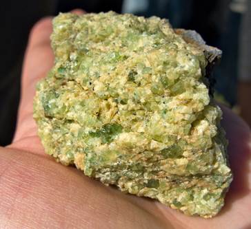
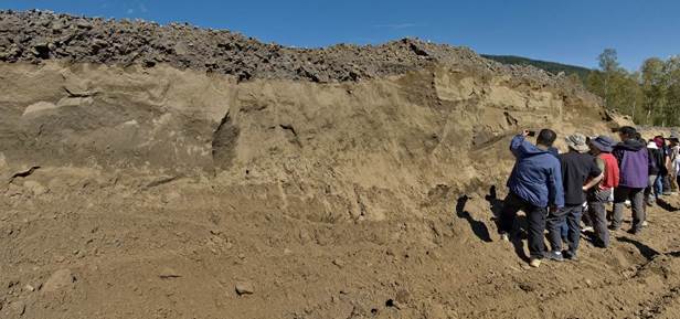
2) 13 km stop, an open pit of loose Lower Pleistocene sediment layers tilted at the azimuth of 15°, angle of 45° (Fig. 9, a, b); 3) 16.7 km stop, Bol’shaya Bystraya quarry, Middle Pleistocene boulder-pebble stratum that includes tourmaline pegmatite boulders (Fig. 10, a, b), 4) 27 km stop, Priirkutnyi and Karyer volcanoes that erupted in the Early-Middle Miocene (Fig. 11, a–d). Deep-seated xenoliths from the Karyer Volcano, derived from the crust–mantle transition zone, show the Pb–Pb isochron age of 2.7 Gyr.
At the end of the day, the participants were accommodated in the VelMan apart-hotel of the Arshan village (Fig. 12).
 а)
а)
 b)
b)
Fig. 9. Lower Pleistocene deposits with inclined bedding of layers: (a), photo 0861, outcrop fragment (b), photo 0860.
Рис. 9. Нижнеплейстоценовые отложения с наклонным залеганием слоев: (а), фото 0861, фрагмент обнажения (b), фото 0860.
 а)
а)
 b)
b)
Fig. 10. General view of the Middle Pleistocene alluvium exposed by the Bol’shaya Bystraya quarry (a), photo 0864-66a and a boulder of muscovite-tourmaline granite from these sediments (b), photo 0872.
Рис. 10. Общий вид среднеплейстоценового аллювия, вскрытого Большим Быстринским карьером (а), фото 0864-66а и валун мусковит-турмалинового гранита из этих осадочных отложений (b), фото 0872.
 а)
а)
 b)
b)
 c)
c)
 d)
d)
 e)
e)
Fig. 11. Basalt covers with columnar joints in the eastern part of the Tunka Valley: a, b – without deep-seated inclusions (Priirkutnyi volcano), photos 0875-75 and 0879-81, c – with deep-seated ones (Karyer volcano), photo 0891-92, d – wehrlite xenolith from the Karyer volcano, sampled during the observation, photo 0896 and e – Pleistocene aeolian sand overlying the lava cover, photo 0873-74.
Рис. 11. Базальтовые покровы со столбчатой отдельностью в восточной части Тункинской долины: а, b – без глубинных включений (вулкан Прииркутный), фото 0875-75 и 0879-81, c – с глубинными включениями (вулкан Карьерный), фото 0891-92, d – верлитовый ксенолит из лав вулкана Карьерный, отобранный во время практики, фото 0896 и e – плейстоценовые эоловые пески, перекрывающие лавовый покров, фото 0873-74.
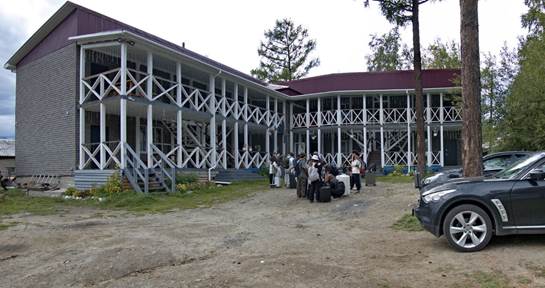
Fig. 12. Accommodation in the VelMan apart hotel in the Arshan village, photo 0906-07.
Рис. 12. Размещение в гостинице «VelMan апарт отель» в пос. Аршан, фото 0906-07.
September 4–5. Routes in the Arshan village and its environs: mudflow, mineral and thermal waters, the master fault of rift valley
The participants went on a hiking route to observe a large-boulder mudflow that descended from the Tunka Ridge and flooded the Arshan village on June 28, 2014 (Fig. 13) (Akulov et al., 2018).
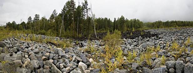
Fig. 13. Debris flows that flooded the Arshan village on July 28, 2014, photo 0911-14.
Рис. 13. Селевые отложения, затопившие поселок Аршан 28 июля 2014 г., фото 0911-14.
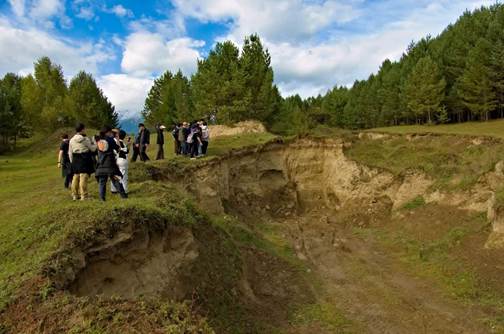
Further, on the way up the valley of the Kyngarga River, the participants observed Lower Cambrian carbonates of the pre-Cenozoic basement affected by cataclasis of the rift valley master fault (Fig. 14) and a natural source of gas-producing carbonated mineral water. Mineral and thermal waters, supplied by drill holes, are used in the Arshan spar for medical treatment of people.
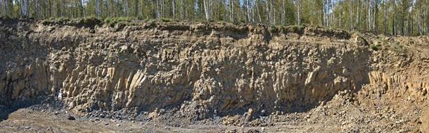
Participants had a bus route to the Khuray-Khobok volcano (Fig. 15), where they observed loess and sand deposits finalizing the 2.5 km thick sedimentary filling of the Tunka depression (Fig. 16). The deposits were described in detail in (Ryashchenko et al., 2014; Alokla et al., 2022).
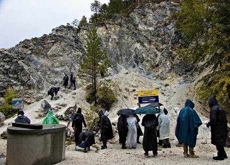
Fig. 14. Cambrian carbonates affected by cataclasis in the Tunka fault, photo 0917.
Рис. 14. Катаклазированные кембрийские карбонаты в Тункинском разломе, фото 0917.
 а)
а)
 b)
b)
 c)
c)
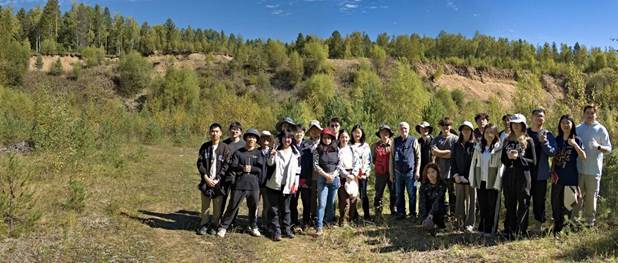
Fig. 15. Khuray-Khobok volcano: a – group photo 0948; b – volcanic slag cut by a basalt dike, photo 0961a; c – loess on the southern slope of the volcano, photo 0952.
Рис. 15. Вулкан Хурай-Хобок: а – общее фото 0948; b – вулканические шлаки, прорванные базальтовой дайкой, фото 0961а; c – лесс на южном склоне вулкана, фото 0952.
During the bus transfer starting from the Arshan village, a stop in the Tunka depression yielded additional observations of Quaternary lavas interbedded with sands on the northern bank of the Irkut River (Fig. 16).
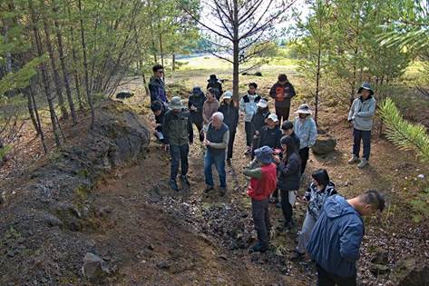
Fig. 16. Pleistocene lava flow overlying the sands on the northern bank of the Irkut River, photo 0977.
Рис. 16. Плейстоценовый лавовый поток, перекрывающий пески на северном берегу р. Иркут, фото 0977.
Then two stops were done on the Kultuk-Irkutsk highway for an initial acquaintance with the rocks of the sedimentary cover of the Siberian paleocontinent. Along the Kultuk-Irkutsk route, in the zone of transition from the basement to the sedimentary cover of the Siberian paleocontinent, the participants observed interbedded coastal-marine Cambrian sedimentary carbonate and terrigenous rocks with wave signs (Fig. 17) and also Jurassic continental coal-bearing sandstones of the Irkutsk basin (Fig. 18). In the evening of September 5, the Chinese participants were again accommodated in the Akademicheskaya Hotel.
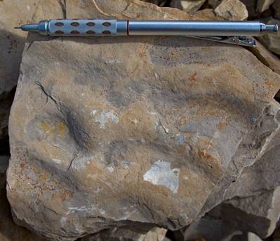
Fig. 17. Wave signs in the terrigenous layer exposed in a road cut on the 36th km of the Irkutsk-Kultuk highway, photo 0986a.
Рис. 17. Волноприбойные знаки в терригенном прослое, вскрытом придорожной выемкой на 36 км тракта Иркутск – Култук, фото 0986а.
Fig. 18. Stop at the outcrop of Jurassic sandstones near Shelekhov town, photo 0987a.
Рис. 18. Остановка у обнажения юрских песчаников вблизи г. Шелехов, фото 0987а.
September 6. Carbonate marine deposits of the Upper Precambrian and continental deposits of the Jurassic on the Siberian paleocontinent
Participants went by bus to the Listvyanka port and boarded the ship Atlant for a Lake Baikal trip.
The first stop was to observe the coastal outcrops of the Jurassic (172–170 Myr) conglomerates of the Sennaya River mouth, at the Cape Skriper base (Fig. 19). Hypotheses on possible sources of numerous pebbles of trachydacite-rhyolite composition in the conglomerates were discussed (Oliferovsky et al., 2023). Lenses of sandstones with plant imprints were found (Fig. 20).
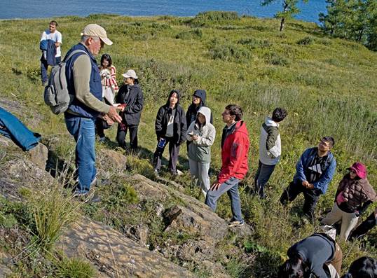
The second stop was to observe the Upper Precambrian stromatolite limestones of the Uluntui formation of the Baikal series at the Bolshoy Kadilny and Maly Kadilny capes. The stromatolites have a local name of the species Conophyton cadilnicus Kor. (Figs. 21, 22) (Dolnik et al., 1970). For these limestones, the Ediacaran Pb–Pb isochron age of 560 ± 30 Myr was obtained (Kuznetsov et al., 2013).
The ship returned to the Listvyanka port (Fig. 23). The participants went by bus to Irkutsk.
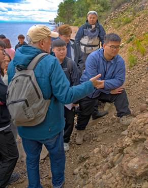
Fig. 19. Jurassic conglomerates on the shore of Lake Baikal. Baikal under the Skriper rock, photo 2010.
Рис. 19. Юрские конгломераты на берегу оз. Байкал под скальником Скрипер, фото 2010.
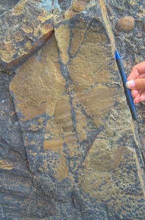
Fig. 20. Plant imprints in a sandstone lens within Jurassic conglomerates, photo 2013.
Рис. 20. Отпечатки растений в линзе песчаников юрских конгломератов, фото 2013.
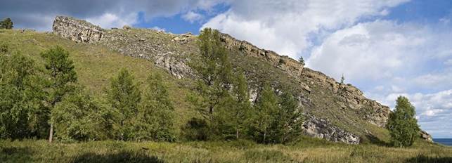
Fig. 21. General view of the outcrop of stromatolite limestones of the Uluntui formation at the mouth of the Malaya Kadilnaya valley. Occurrence of layering — azimuth of incidence 160°, angle of incidence 25°, photo 2082-83.
Рис. 21. Общий вид обнажения строматолитовых известняков в устье пади Малая Кадильная. Залегание слоистости — азимут падения 160° угол падения 25°, фото 2082-83.
 а)
а)
 b)
b)
 c)
c)
 d)
d)
 e)
e)
Fig. 22. Outcrop of stromatolite limestones of the Uluntui formation, photos 2034, 2042, 2048, 2051, 2079.
Рис. 22. Обнажение строматолитовых известняков улунтуйской свиты, фото 2034, 2042, 2048, 2051, 2079.
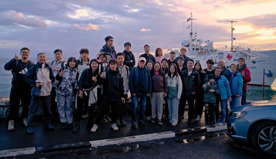
Fig. 23. The final photo near Lake Baikal, photo 2094.
Рис. 23. Заключительное фото на оз. Байкал, фото 2094.
September 7. Final day
The participants met with the Vice-Rector of Irkutsk State University for Research and International Relations D.V. Aksyonov-Gribanov, the head of the International Department of ISU Y.V. Elokhina and the Dean of the Geological Faculty S.P. Primina. Then they visited the center of Irkutsk city before leaving Irkutsk.
Conclusion
In the course of field geological training, the students observed Precambrian, Lower Paleozoic and Mesozoic sedimentary, igneous, and metamorphic rocks that are representative for pre-Cenozoic tectonic units of the Siberian paleocontinent and accreted Khamar-Daban terrane. The lithosphere of these units was generated in the time range covering the much of the Earth’s evolution.
Acknowledgments
Funding for the field geological training was provided by Peking University. Participated in this are 3 teachers and 24 students from the Peking University and three teachers from the Irkutsk State University.
Contribution of the authors
Technical issues of general planning of field geological training were solved by S. Rasskazov. Geological objects of the Tunka Valley (in the Kultuk and Arshan areas) were demonstrated by S. Rasskazov and S. Snopkov, NW coast of Lake Baikal – by S. Kovalenko. Teachers of Peking University B. Zhang, J. Yao and M. Tang gave students additional explanations on the outcrops. Photographing of the objects of the entire excursion was performed by S. Kovalenko. We are grateful to Jiajun Wang for solving technical issues when planning and conducting this trip.
References
Akulov N.I., Akulova V.V., Shtelmakh S.I., Rubtsova M.N., Sholokhov P.A. Structure and composition of mudflows of the Eastern Sayan. 2018, No. 1. P. 41–57. DOI 10.7868/S0024497X18010032 [Акулов Н.И., Акулова В.В., Штельмах С.И., Рубцова М.Н., Шолохов П.А. Строение и состав селевых потоков Восточного Саяна // Литология и полезные ископаемые. 2018, № 1. С. 41–57. DOI 10.7868/S0024497X18010032]
Alokla R., Chuvashova I.S., Rasskazov S.V., Akulova V.V., Rubtsova M.N., Budaev R.Ts. Loess-like rocks on the Khurai-Khobok volcanic cone in the Tunka basin // Bulletin of Irkutsk State University. Earth Sciences Series. 2022. Vol. 41. P. 3–20. https://doi.org/10.26516/2073-3402.2022.41.3 [Алокла Р., Чувашова И.С., Рассказов С.В., Акулова В.В., Рубцова М.Н., Будаев Р.Ц. Лессовидные породы на вулканическом конусе Хурай-Хобок в Тункинской впадине // Известия Иркутского государственного университета. Серия Науки о Земле. 2022. Т. 41. С. 3–20. https://doi.org/10.26516/2073-3402.2022.41.3]
Dolnik T.A., Nikolskiy F.V., Boitman F.F. Geological map of the USSR at a scale of 1 : 200 000. Sheet O-49-XX. Bodaiba series. Explanatory note. Moscow: Nedra, 1970. 58 p. [Дольник Т.А., Никольский Ф.В., Бойтман Ф.Ф. Геологическая карта СССР масштаба 1 : 200 000. Лист О-49-ХХ. Серия Бодайбинская. Объяснительная записка. Москва : Недра, 1970. 58 с.]
Kovalenko S.N. Training field practice on geological surveying in Baikal : textbook. Irkutsk : Izd-vo IGU, 2016. 183 p. [Коваленко С.Н. Учебная полевая практика по геологической съемке на Байкале : учеб. пособие. Иркутск : Изд-во ИГУ, 2016. 183 с.]
Kovalenko S.N., Dekabrev I.K., Yuryev A.A., Bogdanova I.A. Training field practice on geomapping at the Faculty of Geology of Irkutsk University // Geology and Environment. 2023. Vol. 3, No. 2. P. 132–164. DOI 10.26516/2541-9641.2023.2.132 [Коваленко С.Н., Декабрев И.К., Юрьев А.А., Богданова И.А. Учебная полевая практика по геокартированию на геологическом факультете Иркутского университета // Геология и окружающая среда. 2023. Т. 3, № 2. С. 132–164. DOI 10.26516/2541-9641.2023.2.132]
Kovalenko S.N. Geology the western coast of Lake Baikal in the vicinity of the Bolshaya and Malaya Kadilnaya valleys // Geology and Environment. 2025. Vol. 5, No. 3. P. 54–93. DOI 10.26516/2541-9641.2025.3.54. [Коваленко С.Н. Геология западного побережья оз. Байкал в окрестностях падей Большая и Малая Кадильная // Геология и окружающая среда. 2025. Т. 5, № 3. С. 54–93. DOI 10.26516/2541-9641.2025.3.54]
Kuznetsov A.B., Ovchinnikova G.V., Gorokhov I.M., Letnikova E.F., Kaurova O.K., Konstantinova G.V. Age constraints on the Neoproterozoic Baikal Group from combined Sr isotopes and Pb –Pb dating of carbonates from the Baikal type section, southeastern Siberia // Journal of Asian Earth Sciences. 2013. Vol. 62. P. 51–66.
Mazukabzov A.M., Sizykh V.I. About the cover-chessy structure of the Western Pribaikalye // Geotectonics. 1987. No. 3. P. 87–90. [Мазукабзов А.М., Сизых В.И. О покровно-чешуйчатом строении Западного Прибайкалья // Геотектоника. 1987. № 3. С. 87–90.]
Mongush A.R., Bokareva A.A., Podlinov A.N., Prokopchik V.V., Ritter V.S., Maksimov N.M., Kalinin V.S., Zaripov M.S., Dambaev S.A., Kovalenko S.N., Yasnygina T.A., Chuvashova I.S., Saranina E.V., Rasskazov S.V. Similarity and Differences in the Composition of Middle Jurassic and Lower Pliocene Sediments on the North-West Shore of Lake Baikal: Assessment of the Contribution of Clastic Material from the Primorsky Ridge to the Alluvium of the Middle Part of the Pra-Manzurka Valley // Geology and Environment. 2023. Vol. 3, No. 4. P. 51–81. DOI 10.26516/2541-9641.2023.4.51 [Монгуш А.Р., Бокарева А.А., Подлинов А.Н., Прокопчик В.В., Риттер В.С., Максимов Н.М., Калинин В.С., Зарипов М.С., Дамбаев С.А., Коваленко С.Н., Ясныгина Т.А., Чувашова И.С., Саранина Е.В., Рассказов С.В. Сходство и различие состава среднеюрских и нижнеплиоценовых отложений на северо-западном берегу Байкала: Оценка вклада обломочного материала Приморского хребта в аллювий средней части долины Пра-Манзурки // Геология и окружающая среда. 2023. Т. 3, № 4. С. 51–81. DOI 10.26516/2541-9641.2023.4.51]
Oliferovsky R.V., Sedunova E.A., Shametova I.B., Bashkirtsev A.V., Danilin D.A., Mongush A.R. Kovalenko S.N., Yasnygina T.A., Chuvashova I.S., Saranina E.V., Rasskazov S.V. Source of trachidacite-rhyolite pebbles of Middle Jurassic conglomerates on the northwestern shore of Baikal: comparison of pebbles with rocks of magmatic complexes of the Upper Paleozoic and Mesozoic of Transbaikalia // Geology and Environment. 2022. Vol. 2, No. 4. P. 53–79. DOI 10.26516/2541-9641.2022.4.53 [Олиферовский Р.В., Седунова Е.А., Шаметова И.Б., Башкирцев А.В., Данилин Д.А., Монгуш А.Р., Коваленко С.Н., Ясныгина Т.А., Чувашова И.С., Саранина Е.В., Рассказов С.В. Источник трахидацит-риолитовых галек среднеюрских конгломератов на северо-западном берегу Байкала: сопоставление галек с породами магматических комплексов верхнего палеозоя и мезозоя Забайкалья // Геология и окружающая среда. 2022. Т. 2, № 4. С. 53–79. DOI 10.26516/2541-9641.2022.4.53]
Rasskazov S.V., Reshetova S.A., Yasnygina T.A., Chuvashova I.S., Saranina E.V., Rubtsova M.N., Al Hamud A., Hassan A. Upper Miocene-Pliocene deposits of the Pra-Anosovka as a source of the Pra-Manzurka alluvium: Dobaikal transport of clastic material through the South Baikal depression. DOI 10.26516/2541-9641.2023.4.82 // Geology and Environment. 2023. Vol. 3, No. 4. P. 82–107. [Рассказов С.В., Решетова С.А., Ясныгина Т.А., Чувашова И.С., Саранина Е.В., Рубцова М.Н., Аль Хамуд А., Хассан А. Отложения верхнего миоцена-плиоцена Пра-Аносовки как источник аллювия Пра-Манзурки: Добайкальский перенос обломочного материала через Южно-Байкальскую впадину // Геология и окружающая среда. 2023. Т. 3, № 4. С. 82–107. DOI 10.26516/2541-9641.2023.4.82]
Rasskazov S.V., Chuvashova I.S., Snopkov S.V. The Tunka Valley and South Baikal Basin of the Baikal Rift System: introduction into rifting processes in the continental lithosphere // Geology and Environment. 2025. Vol. 5, No. 3. P. 7–53. DOI 10.26516/2541-9641.2025.3.7. [Рассказов С.В., Чувашова И.С., Снопков С.В. Тункинская долина и Южно-Байкальская впадина Байкальской рифтовой системы: введение в процессы рифтогенеза в континентальной литосфере // Геология и окружающая среда. 2025. Т. 5, № 3. С. 7–53. DOI 10.26516/2541-9641.2025.3.7.]
Ryashchenko T.G., Akulova V.V., Ukhova N.N., Shtelmakh S.I., Grin N.N. Loess grunty Mongol-Sibirskogo regiona. Irkutsk : IZK SB RAN, 2014. 241 p. [Рященко Т.Г., Акулова В.В., Ухова Н.Н., Штельмах С.И., Гринь Н.Н. Лессовые грунты Монголо-Сибирского региона. Иркутск : ИЗК СО РАН, 2014. 241 с.]
Sklyarov E.V., Gladkochub D.P., Mazukabzov A.M., Stanevich A.M., Donskaya T.V., Konstantinov K.M., Sintsov A.V. Complexes-indicators of the breakup of the supercontinent Rodinia in the structures of the southern flank of the Siberian Craton (Guidebook of the geological excursion of the scientific meeting "Supercontinents in the geologic development of the Precambrian"). Irkutsk : IZK SB RAS, 2001. 78 p. [Скляров Е.В., Гладкочуб Д.П., Мазукабзов А.М., Станевич А.М., Донская Т.В., Константинов К.М., Синцов А.В. Комплексы-индикаторы распада суперконтинента Родиния в структурах южного фланга Сибирского кратона (путеводитель геологической экскурсии научного совещания «Суперконтиненты в геологическом развитии докембрия»). Иркутск : ИЗК СО РАН, 2001. 78 с.]
State Geological Map of the Russian Federation. Scale 1: 1 000 000 (third generation). Angara-Yenisei series. Sheet N-48. Irkutsk. Explanatory note. St. Petersburg. Kartfabrika VSEGEI. 2009. 574 p. [Государственная геологическая карта Российской Федерации. Масштаб 1 : 1 000 000 (третье поколение). Серия Ангаро-Енисейская. Лист N-48. Иркутск. Объяснительная записка. СПб.: Картфабрика ВСЕГЕИ. 2009. 574 с.]
Rasskazov Sergei Vasilevich,
doctor of geological and mineralogical sciences, professor,
664003, Irkutsk, Karl Marks st. 1,
Irkutsk State University, Faculty of Geology,
Head of Dynamic Geology Char,
664033, Irkutsk, st. Lermontova, 128,
Institute of the Earth's Crust SB RAS,
Head of the Laboratory for Isotopic and Geochronological Studies,
tel.: (3952) 51–16–59,
email: rassk@crust.irk.ru
Kovalenko Sergey Nikolaevich,
Candidate of Geological and Mineralogical Sciences,
664003, Irkutsk, Karl Marks st. 1,
Irkutsk State University, Faculty of Geology,
Associate Professor of the Department of Dynamic Geology,
tel.: (3952)20-16-39,
email: igpug@mail.ru.
Snopkov Sergei Viktorovich,
Candidate of Geological and Mineralogical Sciences,
664003, Irkutsk, Karl Marx st., 1,
Irkutsk State University, Faculty of Geology,
Associate Professor,
664074, Irkutsk, Kurchatov st., 3,
Siberian School of Geosciences, Irkutsk National Research Technical University,
Leading Researcher,
email: snopkov_serg@mail.ru.
Zhang Во,
Associate Professor, Director of Dynamic of Continent and Resource Engineering, School of Earth and Space Science, Peking University,
100871, Haidian, Beijing,
tel.: (086)13693649107
email: geozhangbo@pku.edu.cn
Yао Jinxian,
Associate Professor, School of life Sciences, Peking University,
100871, Haidian, Beijing,
tel.: (086)13661262048
email:jxyao@pku.edu.cn
Tang Ming,
Professor, School of Earth and Space Science, Peking University,
100871, Haidian, Beijing,
tel.: (086)13083595979,
email: mingtang@pku.edu.cn
|
|
Article received: 17.03.2026; corrected: 30.03.2026; accepted: 03.04.2026.
FOR CITATION: Rasskazov S.V., Kovalenko S.N., Snopkov S.V., Zhang Bo, Yao Jinxian, Tang Min. The First Field Geological Practice of Peking University Students in the Baikal Region: Cenozoic Rifting in the Long-Evolution Lithosphere. // Geology and Environment. 2026. Vol. 6, No. 1. P. 166–188. DOI 10.26516/2541-9641.2026.1.166. EDN: KTVUDN